You might have seen videos like this on YouTube: a random photo pops up on the screen, maybe of a deserted road, an unremarkable building, or even a nondescript tree. In the next moment, a guy confidently declares, "This is Taiwan," after just a quick glance. Then, the scene switches to Google Maps, and—surprise—he's right!
That guy is most likely Trevor Rainbolt, a player famous for his skills in the game GeoGuessr. With an incredible knack for recognizing subtle clues in street views—like the shape of utility poles, the design of road signs, the texture of asphalt, and even cloud patterns—he can accurately guess the location of a photo

Guessing Taiwan from utility poles. (Source: WIRED)
Now, it's not just Google Map-loving GeoGuessr players in this "guess the location" game—AI has joined the fray, and in some ways, it's even more precise than humans. This AI, called "GeoSpy," operates differently from humans but delivers equally impressive results, making strides in news verification and crime investigation.
GeoSpy: The AI Expert in Image-Based Location Guessing
If Rainbolt can identify locations in seconds through memory and reasoning, GeoSpy does it in milliseconds using a massive database and machine learning. GeoSpy is an AI platform specifically designed for image geolocation. It doesn't rely on GPS records or any additional information; it can deduce the location solely from the image content, aiding in fraud prevention and law enforcement.
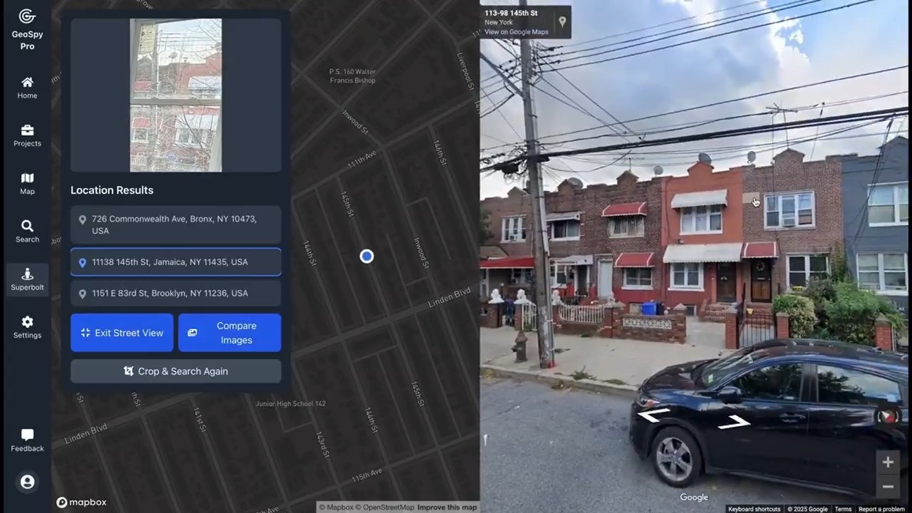
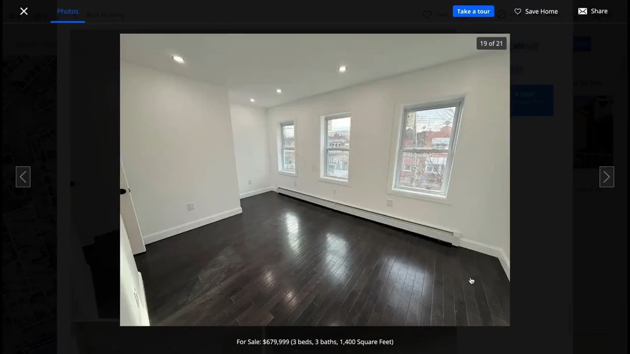
Take this demo image, for example—just an ordinary house listing photo. Yet, by framing the window view with GeoSpy, it can deduce the house's actual location and street view from the blurry and cluttered scenery.

How GeoSpy Works
GeoSpy's ability to accurately identify the location of a photo relies on the following technical components:
1. Visual Embedding Technology
When a user uploads a photo, GeoSpy first converts the image into mathematical vectors, extracting visual features like architectural styles, road signs, vegetation types, and even lighting changes. These features are transformed into a unique "visual fingerprint" to compare with existing data, allowing the AI to quickly find the most similar location from a vast array of images.
2. Global Street View Database Matching
GeoSpy boasts a database of over 46 million GPS-tagged images, covering cities and remote areas worldwide, with regular updates. After the AI reads the image features, it searches the database for the closest match and calculates the probable location based on similarity.
3. Machine Learning
When the AI encounters uncertain or incorrect images, it records the errors and continuously self-trains to improve accuracy. Additionally, GeoSpy can adapt to different lighting and weather conditions, such as nighttime images, cloudy scenes, and even low-resolution or blurry photos. As the data volume increases, GeoSpy's judgment becomes more refined, gradually enhancing its recognition performance.

Applications of GeoSpy
While GeoSpy showcases AI's powerful capabilities in geographic recognition, it also raises privacy concerns. When AI can deduce your location from a photo, does it mean our personal information is becoming even more transparent? As we casually upload views from our windows, street corners, or even daily life photos, it might be worth considering: does this photo unintentionally reveal more information?
At this point, you might feel slightly uneasy about this technology. However, GeoSpy emphasizes that there are many "positive" applications, such as:
- News and Information Verification Journalists can use GeoSpy to verify the authenticity of news images, ensuring that photos match the reported content and preventing the spread of misinformation.
- Crime Investigation and Law Enforcement Police can analyze the possible location of suspects through photos uploaded on social media, aiding in tracking and investigating cases.
- Fraud Prevention GeoSpy can be also used to verify insurance claim photos, rental ads, or images in online transactions, preventing false information and claims.
Currently, GeoSpy is in the testing phase and not open for registration. General users need to sign up to gain access, but if you're curious, you can try the demo on the official website to experience its power.